SSARG have been
investigating a
number of anomalies on the geophysical survey results to try and find out
more about a building uncovered in 2013.
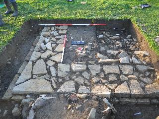
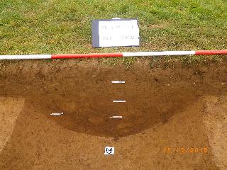
Excavation in 2013 of a rectangular parch mark revealed the foundations of a substantial Roman building.
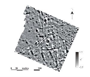
The results of a gradiometer survey revealed a number of linear and irregular anomalies.
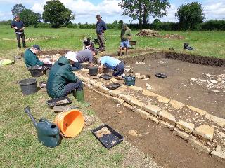
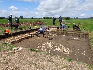
SSARG along with the Martock Local History Group are continuing to investigate this intriguing site. A series of test pits in 2014 targeted anomalies in the geophysical survey, one of which uncovered a Roman grain dryer. In 2016 we uncovered a Roman midden and collapsed building. This year we are exploring the wider landscape and the focus of the work will be geophysics leading to a small series of test pits. We will also be working on post excavation/data processing and forwarding materials to specialists for futher analysis, e.g. shale, glass and radio carbon dating, etc.
2015 excavation of the Roman building at Tithe Mead.
This project was made
possible in part by a grant from the Council for British Archaeology’s Mick
Aston Archaeology Fund, which is supported by English Heritage
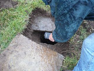
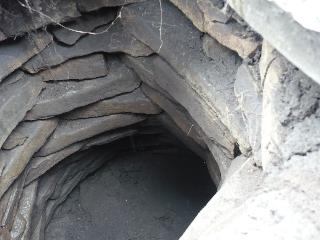
At the end of 2015 SSARG began testpitting at Park near Low Ham around a mysterious stone-lined hole in the ground - possibly an Iron Age well. The test pits uncovered evidence of Iron Age, Roman and post Medieval occupation.
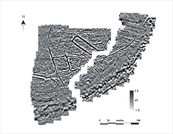
We have also carried out a geophysical survey over the site where there are crop marks which have been identified by
the Somerset HER as a possible Neolithic cursus and mortuary enclosure. The results of the survey are below. We have now completed a series of trenches over some some of these anomalies. The trench over the major rectilinear anomaly uncovered a substantial ditch with a large animal bone at the bottom, a small assemblage of worked flint and one sherd of pottery (prehistoric). This year we are exploring the surrounding landscape, carrying out geophysics in the field to the northeast.
Over the past few years SSARG have been carrying out fieldwork in three adjacent fields at Misterton near Crewkerne which have yielded a large number of finds located and mapped by a local metal detectorist. We have recently completed geophysical surveys of the fields and it is hoped that we will be able to dig test pits on some of the geophysical anomalies at a later date.
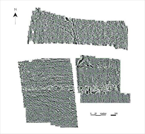
Gradiometer surveys at Misterton.
The results reveal a strong, east-west linear trend across the southern fields which could suggest the site of a linear development including occupation and possible industrial activity. The north-south linear in the northern field could be a former trackway. There is also a possible enclosure in the southwest corner of the north field. Other linear anomalies could represent old field boundaries, drainage and plough marks.
A recent test pit targeted on the possible enclosure in the southwest corner of the north field uncovered a ditch containing Middle Bronze Age pottery and some flints.
Between 2009 and 2011 SSARG carried out a series of
geophysical surveys covering the site of Lufton Villa near Yeovil plus
the fields to the south. The survey area was expanded in 2013 by
SSARG's commercial unit, GeoFlo Southwest Geophysical and Flotation
Services, who surveyed two further fields to the west.
In 2012
and 2013 Newcastle University, in conjunction with SSARG, carried out
excavations based on the geophysical survey results under the direction
of Dr James Gerrard. In Summer 2014 excavations continued a little
further afield, investigating the site of a Deserted Medieval Village to
the southwest of the villa site. In 2015 a trench in the field south of the villa uncovered a series of Roman ditches. In 2016 and 2017 Newcastle University re-excavated the site of the actual Villa to discover its state of preservation and confirm discoveries made during the original excavation in the late 1950s.
A link to the Newcastle University
Lufton Blog is available on the Contact Us page.
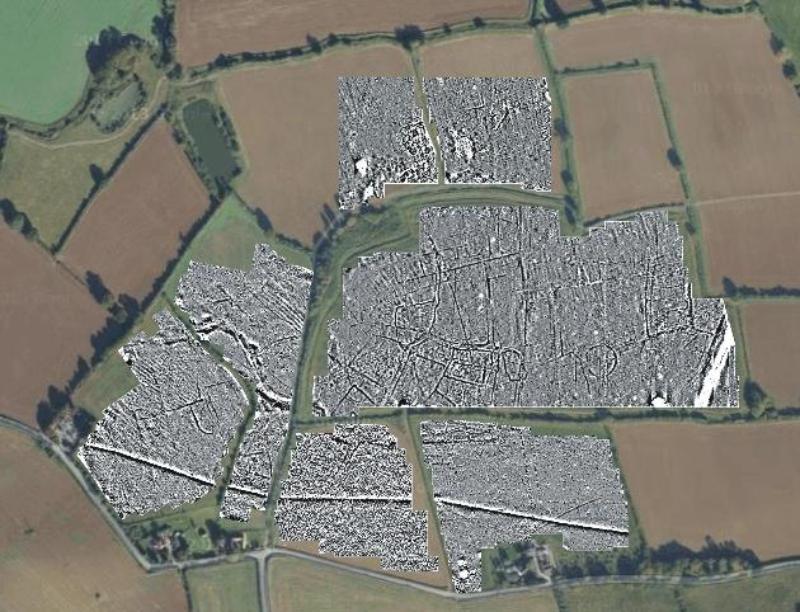
Combined gradiometer surveys of Lufton Villa site and surrounding area. Map data copyright 2014 Google
In the above gradiometer surveys, Lufton Villa is
situated in the most northern field to the left of the central ditch
that divides the field in two. Although the field in which the villa
itself is situated is relatively sparse of anomalies, the fields to the
south reveal complex multi phase activity. Some of these anomalies are
probably contemporary with the villa, but it would seem that this part
of the landscape has seen various phases of occupation over a long
period of time.
Excavations by SSARG and Newcastle University have discovered evidence of Roman, Iron Age and Bronze Age occupation.
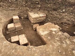
In 2016 excavations uncovered remains of the hypocaust for the bath house.
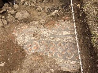
In 2017 the famous Lufton bath house mosaic was re-exacated and assessed for its state of preservation. A mosaic expert was able to precisely identify and re-record which part of the mosaic had been revealed based on Leonard Haywards excavation records from the late 1950s/early 1960s.